| Location : | Southern Asia, between China and India |
| Geographic coordinates: | 28° N, 84° E |
| Map references: | Asia |
| Area: | Total : 147,181 Sq Km Land : 143,181 Sq Km Water: 4,000 Sq Km |
| Area comparative: | Slightly larger than Arkansas |
| Land boundaries: | Total : 2,929 km border countries: China 1,236 km , India 1,690 km |
| Coastline: | 0 km (land locked) |
| Maritime claims : | None (land locked) |
| Climate: | Varies from cooI summers and severe winters in north to subtropical summers and mild winters in south |
| Terrain: | Terai or flat river plain of the Ganges in south , central hill region, rugged Himalayas in north |
| Elevation extremes: | Lowest point: Kechana Kalan 70 m high est point: Mount Everest 8,850 m |
| Natural resources: | Ouartz, water, timber, hydropower, scenic beauty, small deposits of lignite,copper,cobalt ,iron ore |
| Land use: | Arable land : 21.68%, permanent crops : 0.64%, other: 77.68% (2001) |
| lrrigated land: | 11,350 sq km (1998 est.) |
| Natural hazards: | Severe thunderstorms, flooding , landslides, drought , and famine depending on the timing , intensity, and duration of the summer monsoons |
| Environment : | Deforestation (overuse of wood for fuel and lack of alternatives) |
| Current issues: | Contaminated water (with human and animal wastes, agricultural runoff and industrial effluents); wildlife conservation; vehicular emissions. |
| Environment-party to: | Bio-diversity, Climate Change, Desertification , Endangered Species, Hazardous Wastes, Law of the sea, Ozone Layer Protection . |
| International agreements: | Tropical Timber 83, Tropical Timber 94, Wetlands signed , but not ratified: Marine Life Conservation . |
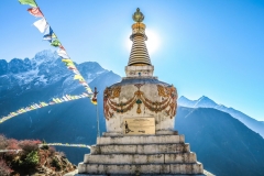
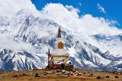
| Geography Note: | Land locked; strategic location between China and India; contains eight of world’s 10 highest peaks, including Mount Everest (the world’s tallest) on the border with China |
Gallery

